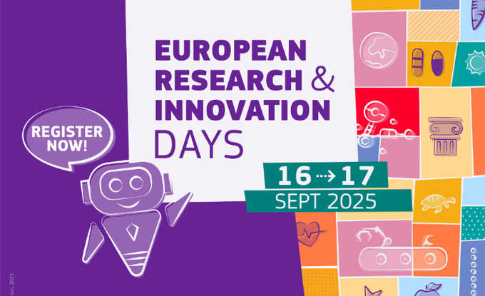
The sixth edition of the Research & Innovation Days will take place on 16-17 September in Brussels (Belgium). Encompassing high-level conferences, engaging panels and networking opportunities, this landmark event aims to discuss how research and innovation drives Europe’s priorities and ambitions on sustainability and industrial leadership. It will bring together different communities such as policy- and decision-makers, business leaders, scientists, and researchers.
Research & Innovation Days will be an exciting opportunity for participants to discover EDITO’s, where a booth and a demonstration of the European Digital Twin of the Ocean will be accessible to the public. Powered by EMODnet and Copernicus Marine Service data, the demo will feature What-if Scenario applications and EDITO infrastructure to show the potential of this tool for better science-based decision-making on ocean sustainability and management. The event will showcase what the EDITO platform offers scientists, analysts, developers, blue economy stakeholders, decision makers and wider citizens across Europe and internationally. You can participate online or in person, come meet and speak to the EDITO Team. Join us to explore and learn about the ocean like never before!
Register here: European Research and Innovation Days 2025 – New Registration
More information on the full agenda, speakers and programme can be found here: Events | The research and innovation community platform

Community Expert Group Resources
About EDITO-Infra
About EDITO Model Lab
FAQs
This work is funded by the European Union under grant agreement no. 101227771. Views and opinions expressed are however those of the author(s) only and do not necessarily reflect those of the European Union or the European Research Executive Agency (REA). Neither the European Union nor the granting authority can be held responsible for them.
Privacy policy | Cookie policy | Website by Seascape Belgium

EDITO ModelLab European Digital Twin Ocean
The EDITO-Model Lab project expanded the numerical and simulation backbone of the European Digital Twin Ocean, delivering a comprehensive suite of modelling and simulation capabilities.
EDITO-Model Lab developed the next generation of ocean models, combining artificial intelligence and high-performance computing for integration into the EDITO public infrastructure, providing access to focus applications and simulations of different what-if scenarios.

Marine Environment Reanalyses Evaluation Project
MER-EP is an international initiative focused on evaluating marine environment reanalyses to maximise their potential for ocean and climate monitoring and prediction. The initiative develops and shares guidelines, methods, tools and best practices for using reanalysis data to monitor the state of the ocean and support applications such as AI forecasting models.
Ocean reanalyses are reconstructions of past ocean conditions created by combining ocean observations with numerical models through data assimilation techniques. These reanalyses can include information on ocean physics, waves, biogeochemistry and sea ice, providing a comprehensive picture of the changing ocean system.

Social-Ecological Analysis and Models for Digital Twin Ocean
SEADITO focuses on developing analytical methods and tools for the European Digital Twin Ocean . It integrates social-ecological models to establish a comprehensive decision support platform.
SEADITO is working to integrate interoperable, spatially explicit socio-ecological models into the EDITO Platform. It advances ecosystem-based management through FAIR data-driven decision-support tools and case studies in the Baltic Sea, North Sea, Mediterranean, and a Pan-European context. Its innovative platform includes visual demonstrators and a powerful Scenario Toolkit (WIST), enabling effective multi-actor processes.

Integration of innovative and reliable socio-ecological models and user-driven solutions into the European Digital Twin Ocean, to facilitate what-if scenarios and decision support, under a co-creation approach
SURIMI focuses on socio-ecological modeling to assess fisheries management impacts and provide user-friendly, scenario-based exploration of sustainable marine solutions. Its modular toolbox incorporates systems such as Ecopath with Ecosim, POSEIDON, and advanced AI-powered interfaces. Developed in close collaboration with stakeholders, SURIMI’s solutions ensure that real-world needs are addressed, promoting transparency, trust, and the long-term adoption of sustainable solutions.
SURIMI’s mission is to develop nine socio-ecological models for integration into the European Digital Twin Ocean.
Forecasting and Observing the Open-to-Coastal Ocean for Copernicus Users
FOCCUS is enhancing coastal monitoring and forecasting through the integration of high resolution observations, coastal models, and forecasting systems spanning the land coast ocean interface.
The project is onboarding coastal data products, models and applications to the EDITO platform to strengthen the coastal dimension of the European Digital Twin Ocean and the Copernicus Marine Service.

Coastal Climate Core Services
CoCliCo is an open source web platform informing users on present-day and future coastal risks with the goal of improving decision-making on coastal risk management and adaptation, by establishing an integrated core service dedicated to coastal adaptation to sea-level rise.
CoCliCo is the tool to plan and manage our response to sea-level rise. It is an interconnection of user engagement, information technologies for geospatial data management and lead science for risk adaptation.

Arctic Cross-Copernicus forecast products for sea Ice and iceBERGs
ACCIBERG is developing a new iceberg forecasting service and improving the quality of Arctic sea ice forecasts across Copernicus Marine and Climate Change services to enhance safety for maritime users navigating Arctic waters.
OpenBerg is a software tool developed by the ACCIBERG project and onboarded onto the EDITO platform to simulate the drift and fate of icebergs in the Arctic. Using data from Copernicus Marine Service, including ocean currents, waves, and wind conditions, OpenBerg can forecast individual iceberg trajectories and generate risk maps identifying areas where icebergs may be encountered. The service is being scaled up to automatically simulate the trajectories of thousands of icebergs detected through satellite observations, supporting improved iceberg forecasting and maritime safety in collaboration with the European Ice Services.

Dimensional data-driven reconstruction of the Mediterranean ecosystem for the study of biophysical interactions and their impact assessment
The objective of the 4DMED-SEA project is to develop a data-driven, 4D reconstruction of the Mediterranean Sea physical and biogeochemical state, exploit this information to further improve our understanding of the complex interactions between physical and biological processes at a broad range of temporal and spatial scales and explore options to transfer that knowledge into new solutions for society regarding the monitoring, restoration and preservation of the Mediterranean Sea Health.

European SEAs CLIMate Impact predictions through regional models
SEACLIM is advancing high-resolution decadal to multidecadal predictions of the marine environment to support climate resilience, ocean governance, and the blue economy.
By downscaling the latest global climate models and integrating them with regional ocean models from Copernicus Marine Service, SEACLIM provides detailed projections on ocean circulation, waves, sea ice, and marine biogeochemistry.
SEACLIM enables pre-operational decadal to multidecadal ocean predictions, developing new regional climate indicators to assess ocean health and coastal hazards. These insights will be integrated into the European Digital Twin Ocean, offering data-driven What-if Scenarios for policymakers, businesses, and coastal communities.

Advancing Black Sea Research and Innovation to Co-Develop Blue Growth within Resilient Ecosystems
BRIDGE-BS aims to advance the Black Sea’s marine research and innovation to co-develop Blue Economy pathways under multi stressors for the sustainable utilization of the ecosystem services.
BRIDGE-BS is designed to define a safe operating space for the Black Sea Blue Economy, ensuring that ecosystem boundaries are known and respected. To achieve this, the project has developed, for the first time in the region, an ensemble modeling framework that provides critical insights into the resilience of the Black Sea which has never been analyzed before. These models, supported by new ecosystem and socio-economic data, deliver results on ecosystem
state under different climate and human-driven pressures. The outputs feed into AI emulators, cumulative effect assessment tools, and “what-if” scenarios, while also supporting the development of
multi-stressor, multi-service Decision Support Tools and adaptive management strategies at both basinwide and Pilot scales. Living Labs across different regions provide additional stakeholder-driven input, reinforcing the co-design of European Digital Twin Ocean applications and enabling risk-based assessments that guide sustainable management of the Black Sea.

Social-Ecological Ocean Management Applications using Digital Ocean Twins
SEADOTs empowers sustainable ocean management by integrating social-ecological data into the European Digital Twin Ocean. This EU-funded initiative is aimed at transforming ocean management by merging cutting-edge ocean data with socio-ecological and socio-economic models.
SEADOTs further strengthens the European Digital Twin Ocean by developing next-generation socio-ecological models for inclusive, informed, and adaptive marine governance. Focusing on demonstration sites in the Norwegian North Sea, Southern North Sea, and the Baltic Sea, SEADOTs works hand-in-hand with policymakers, marine managers, and local stakeholders. Its interactive platform enables scenario-based policy exploration, supported by learning materials that foster digital ocean literacy.

Integration of biodiversity monitoring data into the Digital Twin Ocean
DTO-BioFlow unlocks currently inaccessible marine biodiversity data and integrates it into the European Digital Twin Ocean, transforming fragmented data into accessible knowledge to support marine research and monitoring.
DTO-BioFlow brings marine biodiversity data into action within the European Digital Twin Ocean. Through eight policy-relevant demonstrator use cases, the project integrates harmonised biomonitoring data with AI, models, analytical tools, and high-performance computing to address key marine ecosystem and policy challenges aligned with EU biodiversity objectives. By strengthening the operational biodiversity component of EDITO, DTO-BioFlow supports evidence-based decision-making for sustainable ocean management.
The Ocean Bulletin is an open web platform that helps maritime professionals plan routes at sea factoring meteorological and oceanographic conditions into predicted arrival times, fuel consumption, and CO₂ emissions. This application is meant as an EDITO integration aimed for a global audience, allowing users to simulate voyages anywhere on the global ocean, or between specific ports, and to compare performance across multiple types of vessels.
This application simulates a water column anywhere around the world, allowing users to explore the selected water column’s response to pressures.
This application provides real-time position of the low tide bathymetry line observed from satellites, which is useful for navigability and planning maritime operations.
The Global AI-Ocean Forecasting System (GLONET) provides an on-demand, fast, configurable and interactive framework that can be activated easily and quickly everywhere in Europe and in the world Ocean.
This application provides an accurate, resource-efficient and accessible tool for seasonal prediction of chlorophyll concentration. Chlorophyll concentration is an important indicator linked to marine ecosystem health, productivity and fisheries.
This application offers a web interface with a thematic approach to data, allowing users to create maps and graphs and to apply on-the-fly processing to deliver a comprehensive picture of the ocean on a given topic and/or area.
This application aims to improve the modeling of key tuna species spatial dynamics under the influence of essential ocean variables. It uses model projections from the Intergovernmental Panel for Climate Change (IPCC) to explore the future of tuna populations and their fisheries.
This application aims to support coastal and marine planning by enabling proactive responses to sargassum influxes across the Equatorial Atlantic and surrounding Exclusive Economic Zones (EEZs).
This application shows the impact of ocean observing systems -including in situ observations and satellites observations- on the ocean forecasts from the models. It provides access to information about observations assimilated to model (GLO12) and features to compare simulations with or without observations.
This application provides local information on people and buildings at risk in coastal areas, offering an assessment based on selected parameters, including “Shared Socioeconomic Pathways” (SSPs) scenarios, time scale and types of extreme events. This interactive experience about coastal risks and adaptation is powered by the Coastal Climate Core Service (CoCliCo) project.
Simulate the hydrodynamic impact of seagrass on coastal erosion to support coastal protection agency, decision makers and scientists to take nature-based decision. Demonstrator based on the What-if Scenario on NBS, developed by HEREON in the frame of the EDITO Model Lab project focused on the Wadden Sea (Germany) and the Songor Lagoon (Ghana).
This application simulates how limiting fisheries during certain months can lower the risk of impacting turtle populations. Harnessing turtle drift simulations developed with Copernicus Marine products, and using EDITO, the application demonstrates how ocean knowledge and modelling can be used to protect biodiversity.
This application provides information on the exposure of local regions to plastics coming from terrestrial origin, including level of exposure, origins and travel time. It provides “what-if” scenario options to examine the effect on the local exposure footprint of potential reductions of plastic emissions at (distant and local) source.
This application presents the EU infrastructures -the in situ and satellite observing systems- underpinning the development of the EU Digital Twin Ocean and the stakeholders involved.